30 years ago in 1996, the Irving Whale was raised from the water of PEI, after it sunk in 1970. The barge was loaded with Oil and PCBs and leaked for 26 years untill it was removed. After it was cleaned up, it was converted to a deck barge, and renamed Atlantic Sealion. The Barge is currently tied up at COVE in Dartmouth.
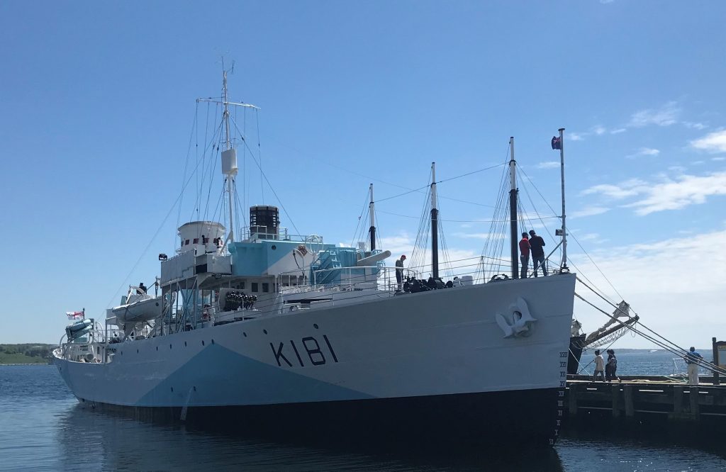
HMCS Sackville reemerged this summer after extensive steel work to reinforce her hull. Corvettes were built quickly and cheaply in the second world war, and were built to last the war. Sackville is the last of her type in the world.
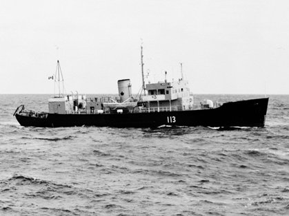
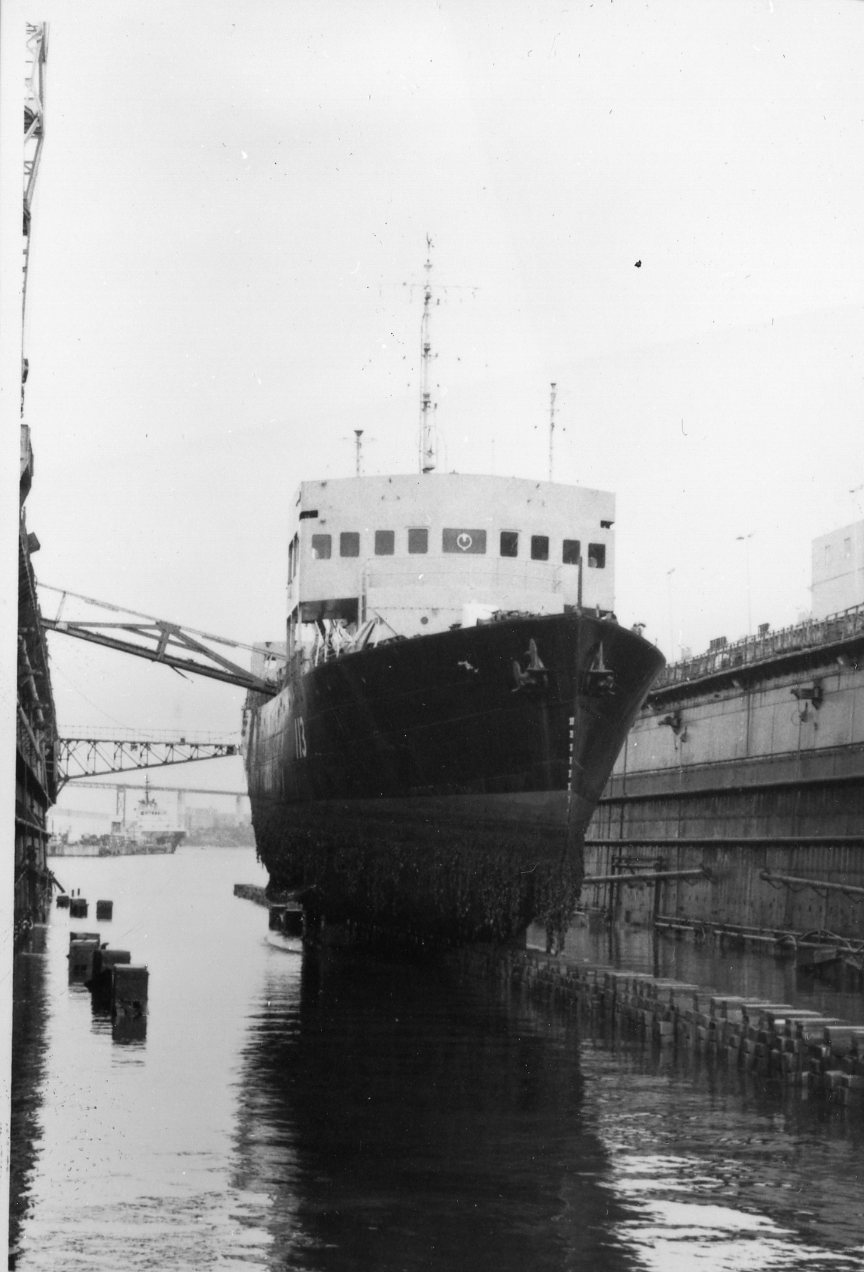
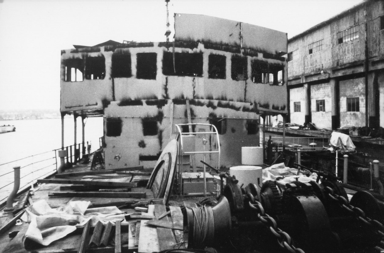
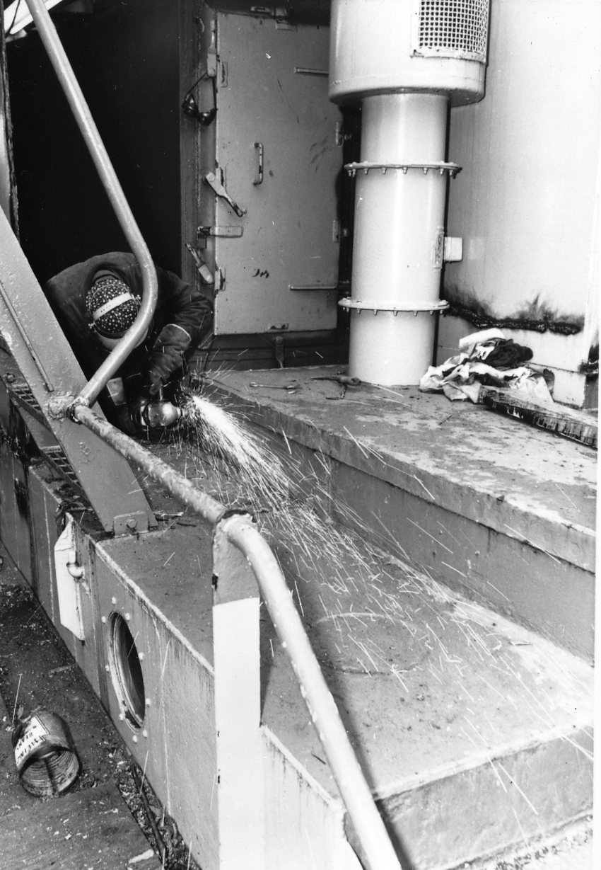
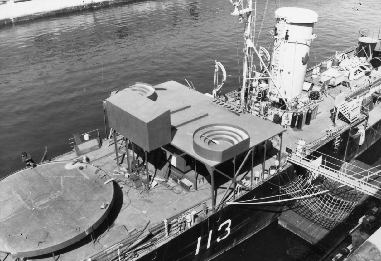
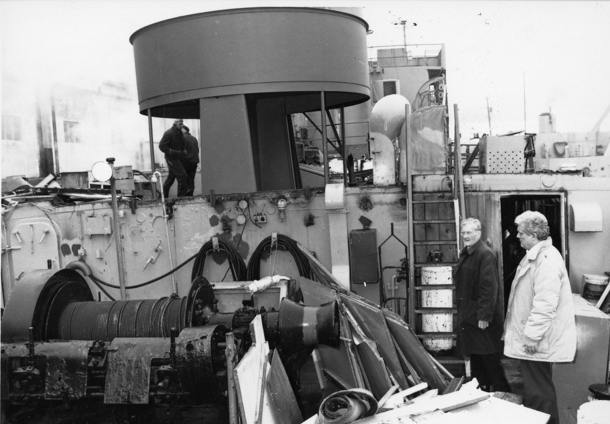
After the war, Sackville become AGOR 113, a navy survey vessel. She was eventually retired, and in 1984 began being restored to her wartime appearance. The Following photos are part of the Maritime Museum of the Atlantic’s Slide Collection, and show some of that early restoration work.
AGOR 113 at Halifax Shipyards to have her through hull sealedAGOR 113 alongside Pier 2 for removal of the modern bits.New Bridge structure and Gun platform have been installedA/A gun tub on the Engine room casing.
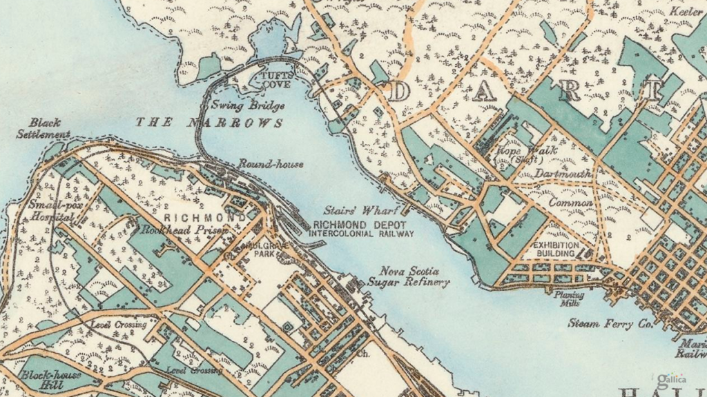
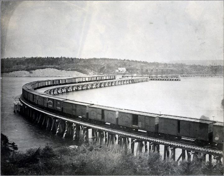
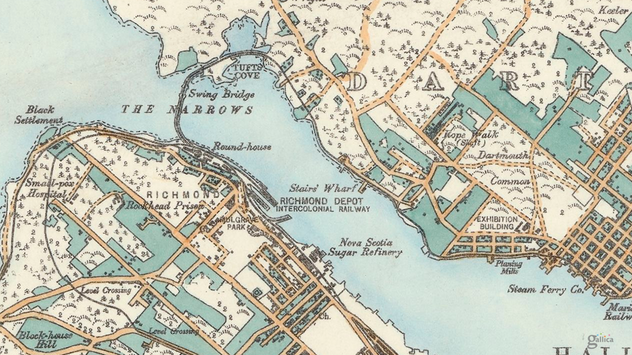
The first bridge spanning Halifax Harbour was a railway bridge constructed by the Intercolonial Railway at the Narrows. It was constructed between 1884-85 and was 650 feet long.
1889 Hopkins Map of Halifax.
Intercolonial Railway engineer P.S. Archibald designed the bridge in a concave form with the convex facing Bedford Basin in the hope this shape would help the bridge withstand ice slides each spring.
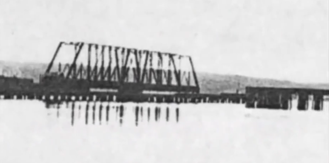
A Dartmouth man, Duncan Waddell, was in charge of construction for the huge stone pier upon which the swing section or “draw” of the bridge would rest, so vessels could be allowed to move into Bedford Basin. The stone pier, located near the Dartmouth shore, was constructed in about 35 feet of water, by driving piles into the gravel bottom to a depth of five or six feet. These acted as guides for building the pier, which was to hold the bridge, being built by the Starr Manufacturing Company of Dartmouth.
The wooden trestle-work of the bridge, constructed by M.J. Hogan of Quebec, rested on eight foot stone-filled cribs, spaced on the harbour bottom every 10 feet (3.0 m). The piles were then secured to the cribs. As the depth of the water was about 75 feet the piles had to be built in three sections, and spliced with eight-inch deals (basically an 8″ long plank) spiked into place. This proved to be extremely weak, especially when no form of side-bracing was used.
A hurricane hit Halifax on Monday evening September 7, 1891. The storm caused damage to wharves and shipping in harbour. The bridge was destroyed. Nothing remained the next morning but a few broken timbers and some trestles in shallow water.
Suggestions were put forward by Dartmouth Town Council that it would be better to construct the railway line along the shoreline from Bedford to Dartmouth, rather than rebuild the bridge. However, the federal government decided to rebuild the structure, stating that the land route was not “deemed advisable.” Like the first bridge, it was poorly constructed and not braced. This time it was built in a straight line and thus made much shorter. Completed in 1892, the contractor was Connor’s of Moncton, New Brunswick.
About 2:00am, on July 23, 1893, almost two-thirds of the bridge slipped into the water. The last train had crossed about 6 hours prior. The cause of the breaking away of the Narrows Bridge was to be the result of sea worms. It was discovered that the piles were worm-eaten almost through between high-water and low-water mark. When the last train went over, it is assumed that these rotten supports gave way, but remained resting on the surface. Then, when the tide rose, the bridge desk floated up and the whole thing swept away.
The loss of the second bridge then led to the establishment of the rail line to Windsor Junction in 1896. The third harbour crossing is the Macdonald bridge.
The firm of Monsarrat and Pratley were engaged to carry out studies of a possible high-level highway bridge linking the 2 sides of the harbour as far back as 1928. The bridge location between North Street in Halifax, and Thistle Street in Dartmouth was approved by Dominion Authorities and the British Admiralty in 1933. The 1945 master plan for Halifax assumed that this would be the location for the bridge, and suggested widening North Street to accommodate traffic. Dartmouth’s master plan of 1945 also assumed this would be the location.
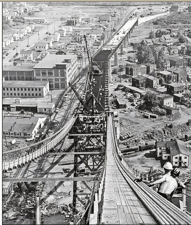
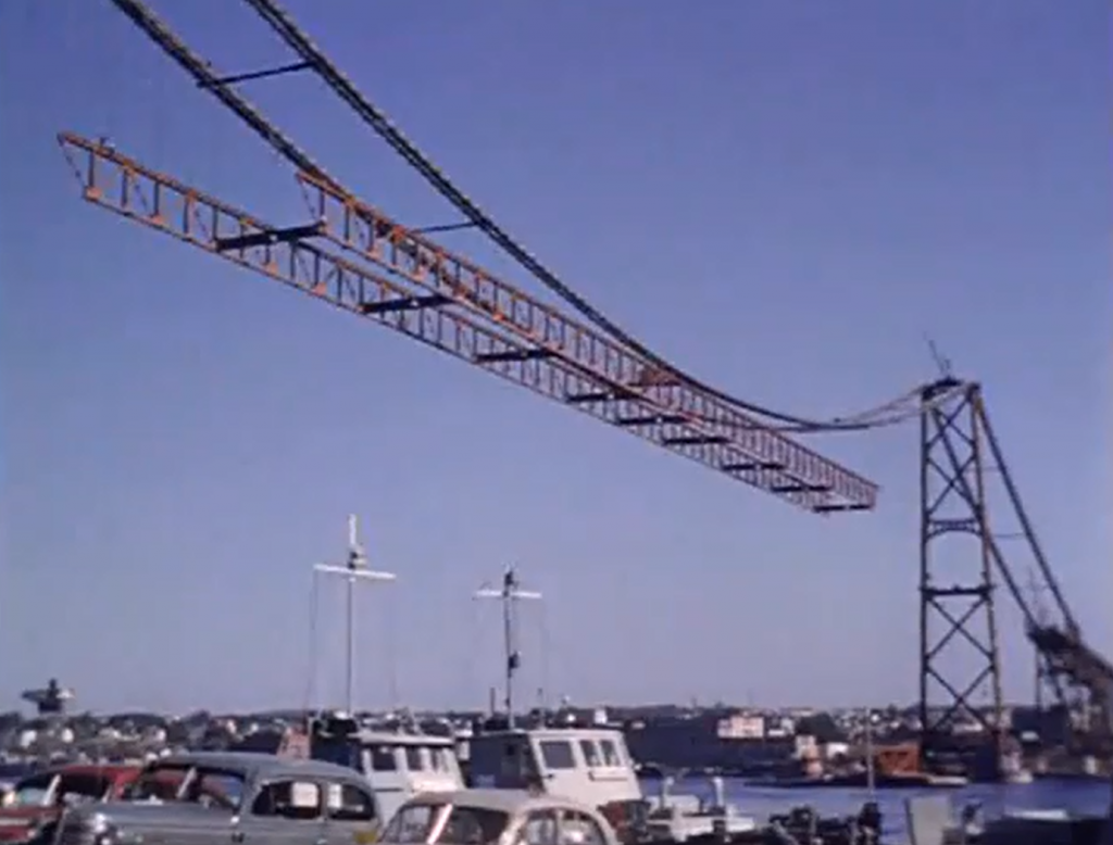
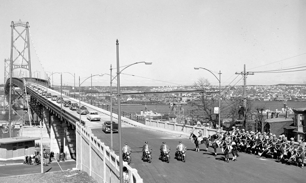
The bridge was designed by Philip Louis Pratley, one of Canada’s foremost long-span bridge designers who had also been responsible for the Lions Gate Bridge in Vancouver. By the time design work began in 1950, he was working alone. The contractor was Dominion Bridge Company Ltd. When erected at a cost of CAN $10.75 million, the Macdonald Bridge was the second longest span of any suspension bridge in the British Commonwealth, after only Vancouver’s Lions Gate.
Pratley worked on many of the large bridges in Canada, including the Jacques Cartier in Montreal, the Quebec Bridge, and the Saint John Highway Arch Bridge. One of the lesser known landmark bridges designed by Pratley was the Sheet Harbour Bridge (1957–1958), crossing over the East River at Sheet Harbour, Nova Scotia. On its erection, the through-steel arch structure of 465 ft span was the second longest-span highway bridge in Nova Scotia. It was replaced in 2015. Pratley was also appointed to the American committee formed to investigate the failure of the Tacoma Narrows Bridge.
The Dominion Bridge Company itself was formed in 1896, and lasted until 1998, when it went bankrupt after purchasing the MIL Davie Shipyard. The last remaining Dominion Bridge facility is a plant in Amherst, operated by the Cherubini group, who will be doing the steel fabrication of the new pieces for the bridge. Pratley’s son Hugh was involved in the site supervision and took over the operation of the consulting firm on the death of his father in 1958. Construction on the Macdonald Bridge began in 1952, and took 3 years. During construction, 6 workers were killed.
The Macdonald Bridge opened to the public on April 2, 1955.
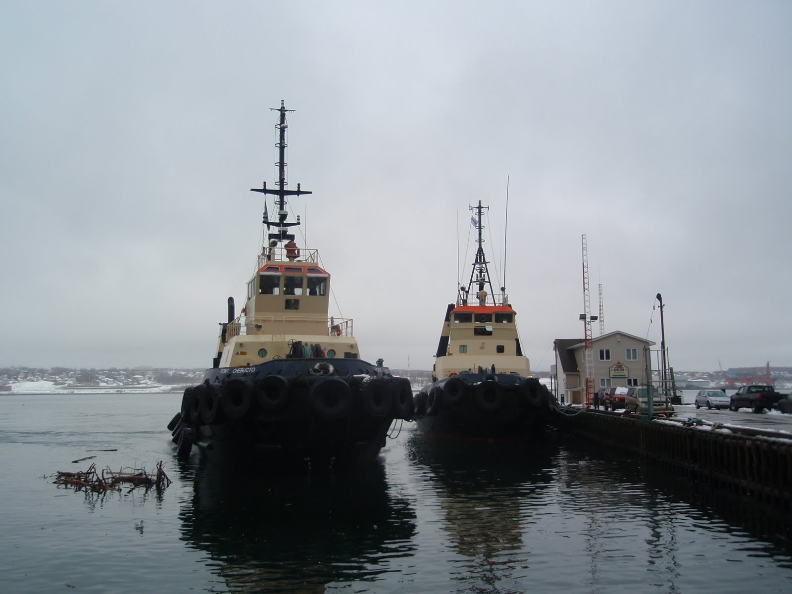
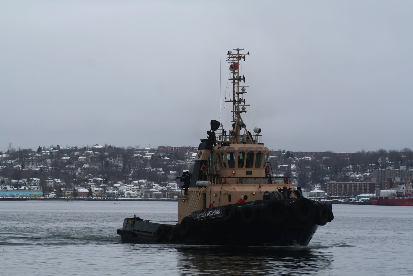
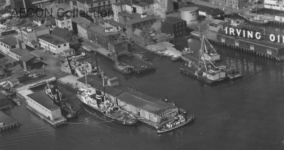
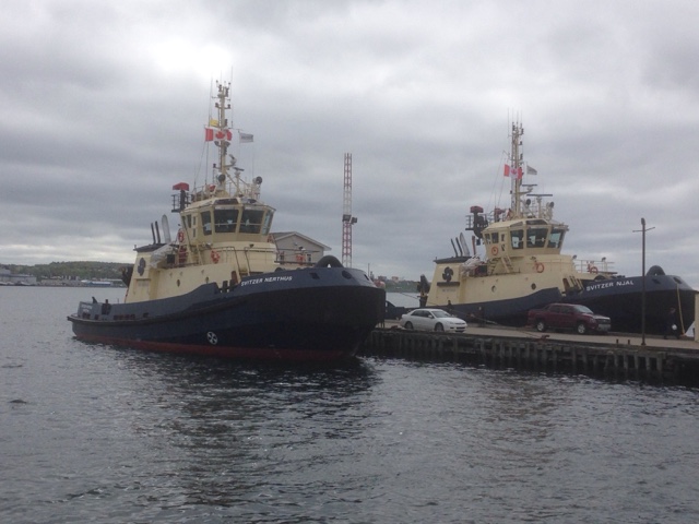
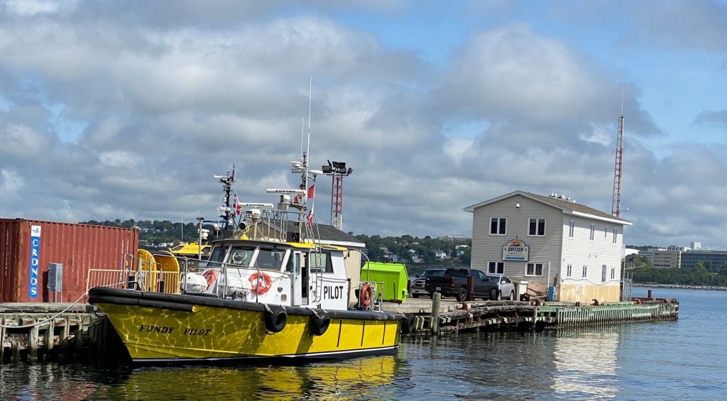
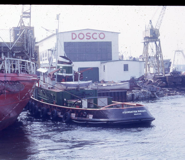
The former Foundation maritime wharves, now known as ECTug (short for Eastern Canada Towing and Salvage) which was what foundation maritime became when spun off from Foundation Co. (now AECON). ECTUG is now Svizter Canada.
Halifax has a history of Sea Stories, Men Left Halifax to fight in multiple wars, Privateers returned with their captured prizes. The stories that came out of Foundation Maritime were so immense, they filled 2 volumes by Farley Mowat; Grey Seas Under, and The Serpents Coil.
Foundation Maritime grew out of the Foundation Company of Canada, which was a construction firm who owned barges and dredges for constructing Harbour works. They needed a Tug, and found the Laid up ex HMS Frisky, renamed Gustavo Ipland, in Hamburg Germany. They purchased her, and Named her Foundation Franklin in 1930.
Having a tug, eventually led to it being chartered for salvage work, and Foundation Maritime was born. As the years went on, many additional tugs were purchased and chartered, and the business expanded to include terminal operations, towing and salvage. Foundation Maritime shrewdly perusing Business and ships in distress.
For much of its early years, even finding a ship in distress was a problem. Modern electronic navigation systems were not invented yet, and ships were guided by the stars. in a storm, or cloud cover, it could be days before you could confirm your position. This is also the case with the distressed vessel being sought. their position was days old, and may not have even been correct to begin with. if you could reach them on the radio, it might have been possible to RF Direction find them,Though during the wars, this was a asking to be sunk by a uboat.
The Foundation Company of Canada Still exists today as the construction firm AECON. Foundation Maritime Sold its tugs in 1973, Leading to the formation of Eastern Canada Towing and Salvage (EcTug). the tugs retained their names, however Point was substituted for Foundation in their names. ECTug was then acquired, and eventually became Svitzer Canada.
In 2010 they signed a MOU with Atlantic towing, With Atlantic Towing taking over Halifax operations, and Svitzer working Port Hawksbury/ Straight of Canso area. Svitzer last used the wharf in 2015, and Sold the property to Develop Nova Scotia last year.
More recently, the Atlantic Piliots Authority has made use of the wharves.
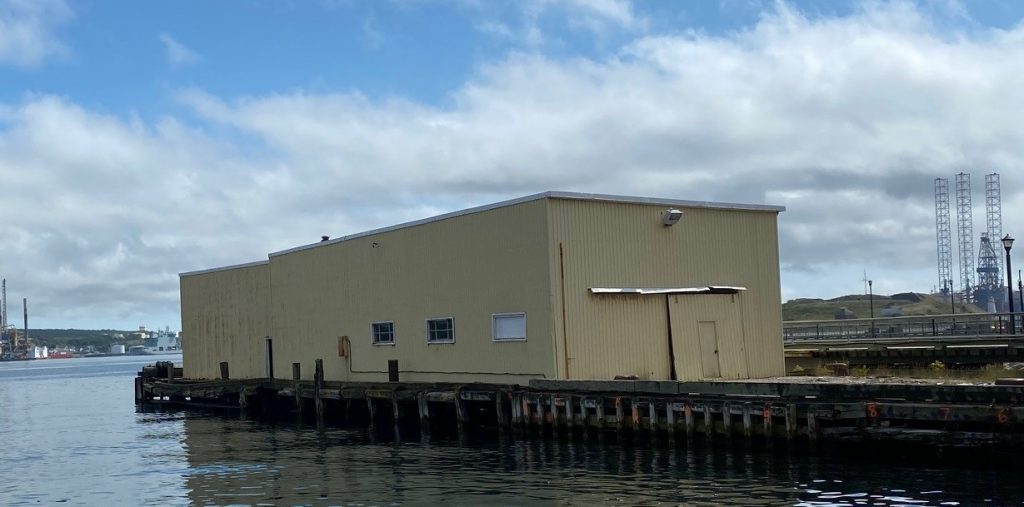
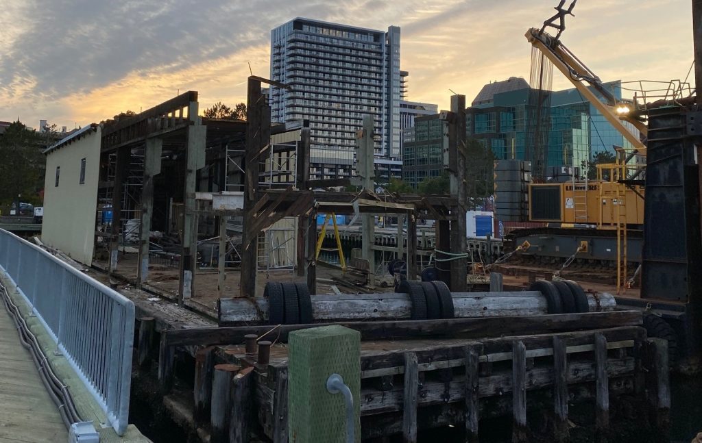
The foundation Maritime wharves still stand, at the foot of Salter St. for a few more days, to be replaced by a single new wharf to support marina operations.
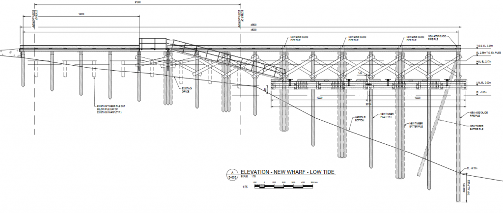
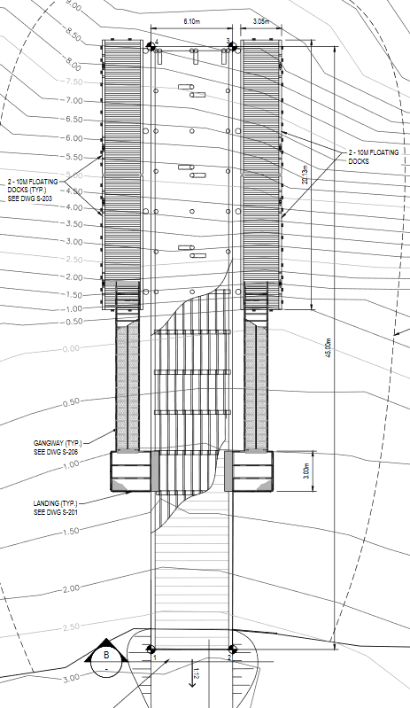
Develop Nova Scotia today released the RFQ for construction of a new wharf on Georges Island. The project will see the existing wharf cut down, and a new pile structure twice its size constructed.
The new wharf will be 135′ long, and 18′ wide. there will be 60′ of Floating dock on either side of the main wharf to allow for boat access. Deadline for bids is Sept 17.
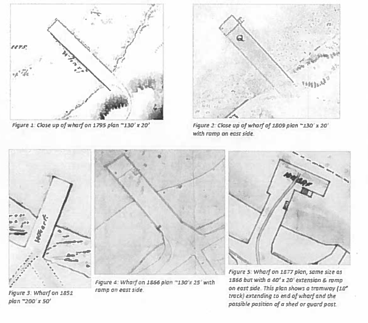
The Current wharf was built in 2004, and is built over the ruins of previous wharves. The first wharf was constructed by 1784, and was historically 130′ in length, and 20-25′ wide – the approximate dimensions to the proposed structure.
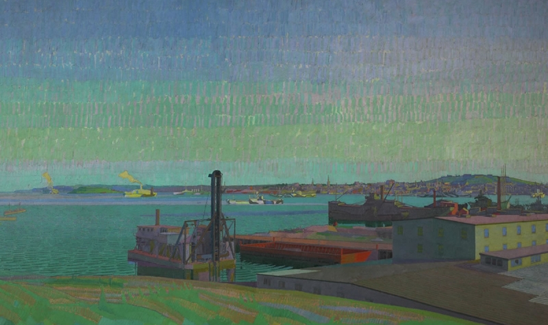
Harold Gilman, Halifax Harbour, 1918. Oil on canvas, 198 x 335.8 cm. National Gallery of Canada, Ottawa. Transfer from the Canadian War Memorials, 1921. Photo: NGC The Painting looks to be looking south, from Dartmouth cove.
The paintings Halifax Harbour, the largest and most ambitious work executed by British artist Harold Gilman, and Winter Camouflage, by Group of Seven co-founder Arthur Lismer, are at the heart of the new exhibition Masterpiece in Focus: Halifax Harbour 1918. The show, which marks the 100th anniversary of the end of the First World War, is presented at the National Gallery of Canada from October 12, 2018 to March 17, 2019. It is organized in partnership with the Art Gallery of Nova Scotia, where the exhibition will be on display from April 12 to September 2, 2019.
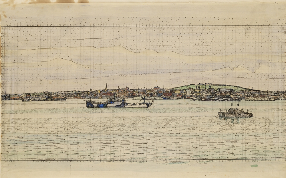
Harold Gilman, Halifax Harbour, 1918. Ink and watercolour on paper, 33.5 x 54.5 cm. Gift of Mrs Harold Gilman (no.VAG 31.57). Collection of the Vancouver Art Gallery.
In 1918 the Canadian War Memorials Fund (CWMF) commissioned artists Harold Gilman (1876–1919) and Arthur Lismer (1885–1969) to depict the war effort at the port of Halifax. The assignment came after the most destructive explosion of the First World War, when a freighter collided with a munitions ship in the Halifax harbour in 1917 killing nearly 2,000 people and injuring thousands more.
Featuring 35 works, including preparatory paintings and drawings, sketches, prints and photographs, Halifax Harbour 1918 explores how these two painters-turned-war-artists approached their respective missions during a critical moment in the history of Canadian landscape painting and the challenges they faced while working in Halifax in the aftermath of the tragedy. For the first time, Gilman’s monumental canvas can be viewed alongside his preparatory works.
A bilingual and fully illustrated catalogue, as well as essays by Anabelle Kienle Poňka, Lily Foster and Sarah Fillmore accompanies the exhibition. Co-published with Goose Lane Edition. Available at the Boutique at the price of $35, or online at shopNGC.ca
Halifax Harbour, 1918, organized by Kienle Poňka and Gilman scholar Lily Foster, includes loans from the Art Gallery of Nova Scotia, the Canadian War Museum, Beaverbrook Art Gallery, the Vancouver Art Gallery, the British Council, the Higgins Art Gallery & Museum in Bedford, England, and private collections. Following its run at the Gallery, the exhibition will be on view at the Art Gallery of Nova Scotia from April 12 to September 2, 2019.
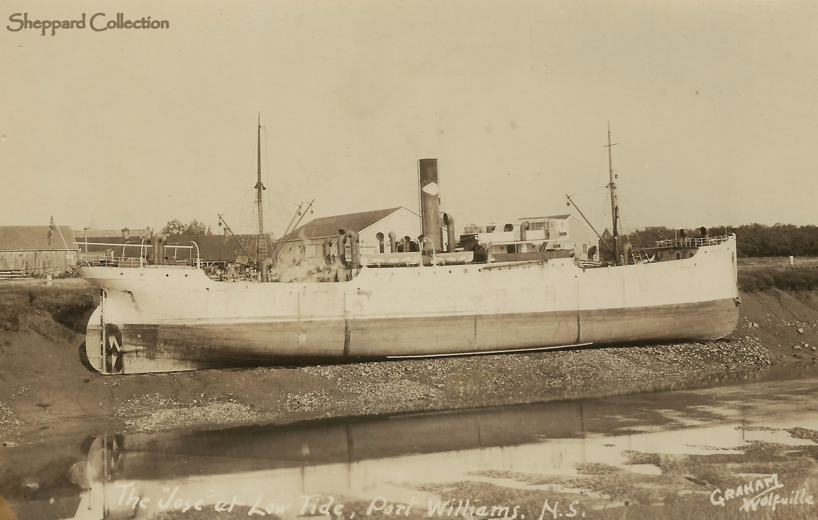
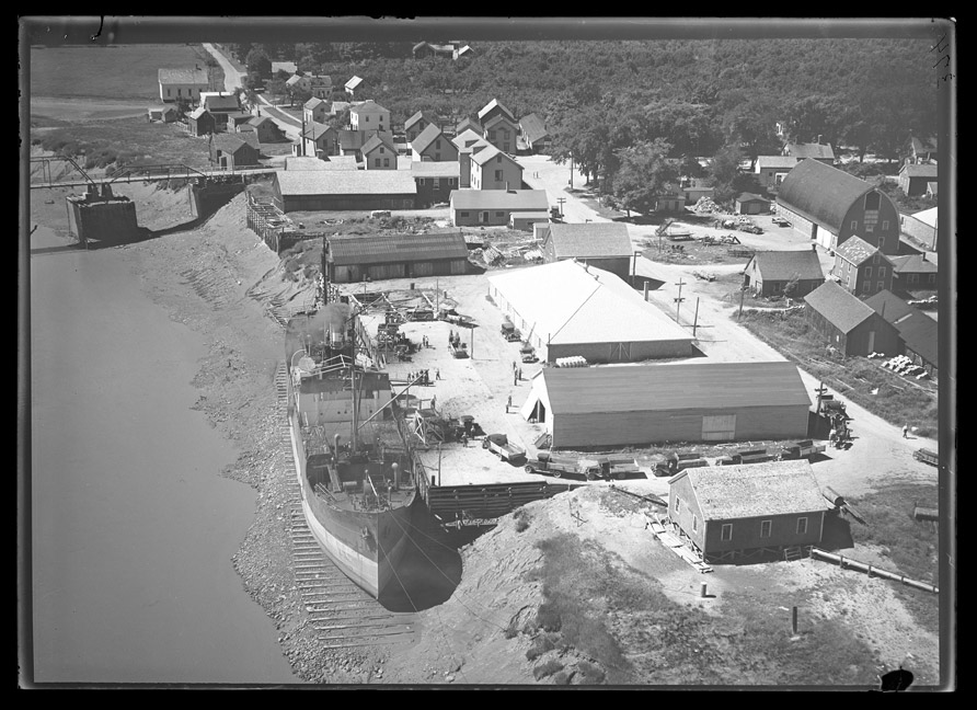
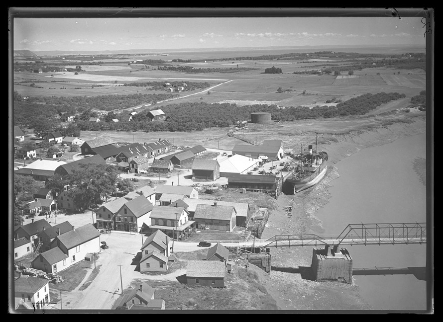
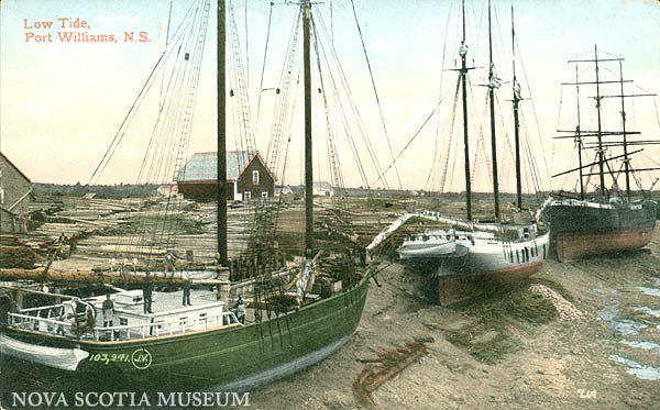
Port Williams today is home to a number of Breweries, Distilleries and wineries. As you cross the Bridge over the Cornwallis river, On your Right, is a run down dock. That dock was once heavily used, and as the photos below show ships simply sat on the bottom when the tide was out.
The practice evidently had a long history, as an earlier postcard shows smaller Sailing vessels sitting on the bottom earlier.
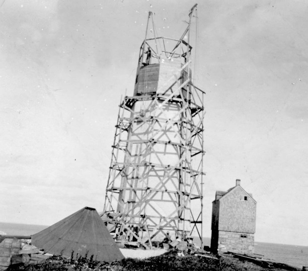
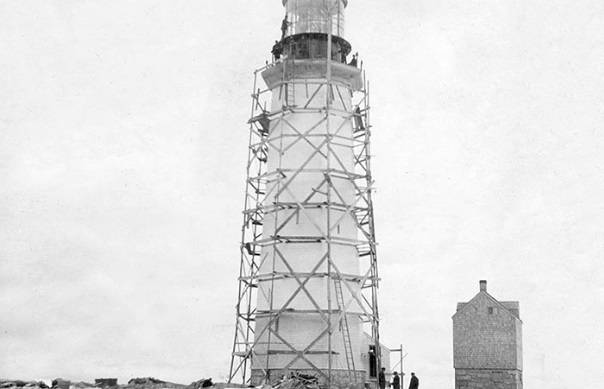
The need for a landfall lighthouse for Halifax was apparent early on, and in 1752 a lottery was formed to fund the construction. It failed to raise the necessary funds, and the first act passed by the first legislature in 1758 was a tax on ships to fund the light. The Nova Scotia Archives recently released a number of documents and photos related to the Light, including the Tax Records for the lighthouse funding.
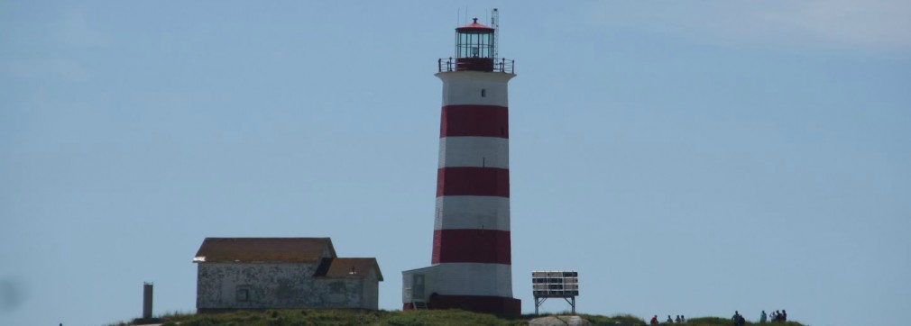
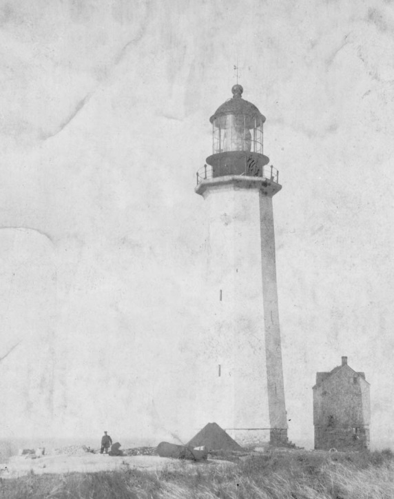
Landfall lighthouses are tall structures, designed so that the light can be seen at a great distance, to point ships to a harbour. The light is octagonal in shape, and constructed of masonry, covered with wooden shingles due to early moisture issues.the Sambro Island Light is visible for 24 Nautical miles (44km)
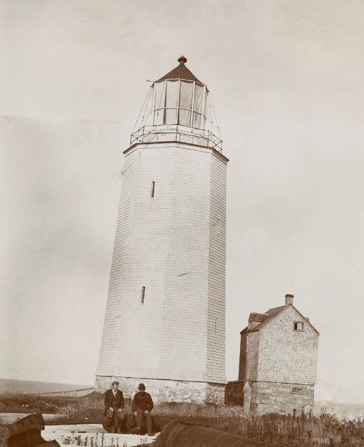
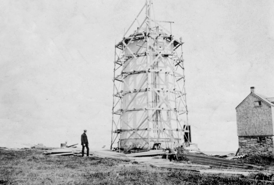
(Above) Sambro Island Light as built, An additional 22′ of height was added in 1906 to increase the lights Range.
(above) the Heightening of the Sambro Light. Photos from the Department of Transportation Albums at the Nova Scotia Archives. (below) the completed tower. the Red White the stripes were added in 1908.
The Sambro Light is the oldest Lighthouse in North America and the Caribbean. Louisburg’s lighthouse was originally built in 1733, but was destroyed by the British during the Siege of Louisburg. Boston Light location dates to 1716, but the original was destroyed in 1776 by the British, during the revolutionary war. The current light was rebuilt on the foundations of the original light in 1783.
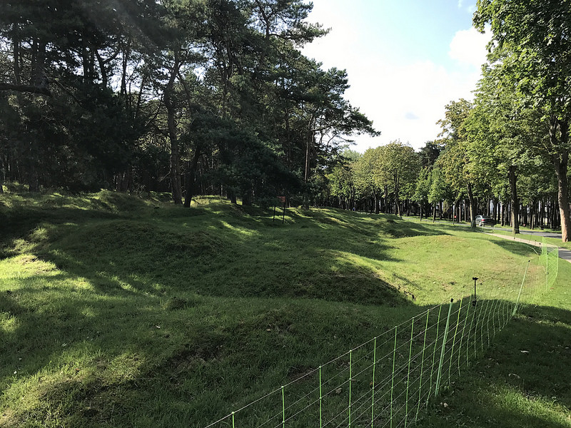
100 years on, Vimy Ridge is almost idealic. the trees are mature the grassy rolling landscape hides the the knowledge that 100 years ago this was mud, and each roll is a shell crater, so close together they merge. Up on the ridge, you can walk through the trenches – the German lines so close you could yell at them.
The fence warns of live munitions. the surrounding countryside has been plowed over and returned to agriculture. Shells and other explosives are to this day still dug up accidentally by locals. its one thing to hear the stories. its something else to walk the grounds, and see for yourself.